
2020 Beirut Blast Injury Study
Investigating Spatial and Contextual Factors Influencing Injury Patterns and Severity
Background
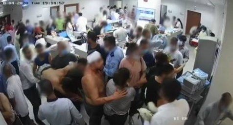
On 4th August 2020, approximately 2750 tonnes of Ammonium Nitrate stored in the port of Beirut ignited, causing a huge explosion that damaged large parts of the city. The explosion caused at least 218 fatalities, injured more than 7,000 and left an estimated 300,000 people homeless [1]. With explosive violence becoming more urbanised, and the high proportion of casualties being civilian [2], the Beirut blast offers an opportunity to gain deeper understanding of the relationships between injury outcomes, blast exposure and urban characteristics.
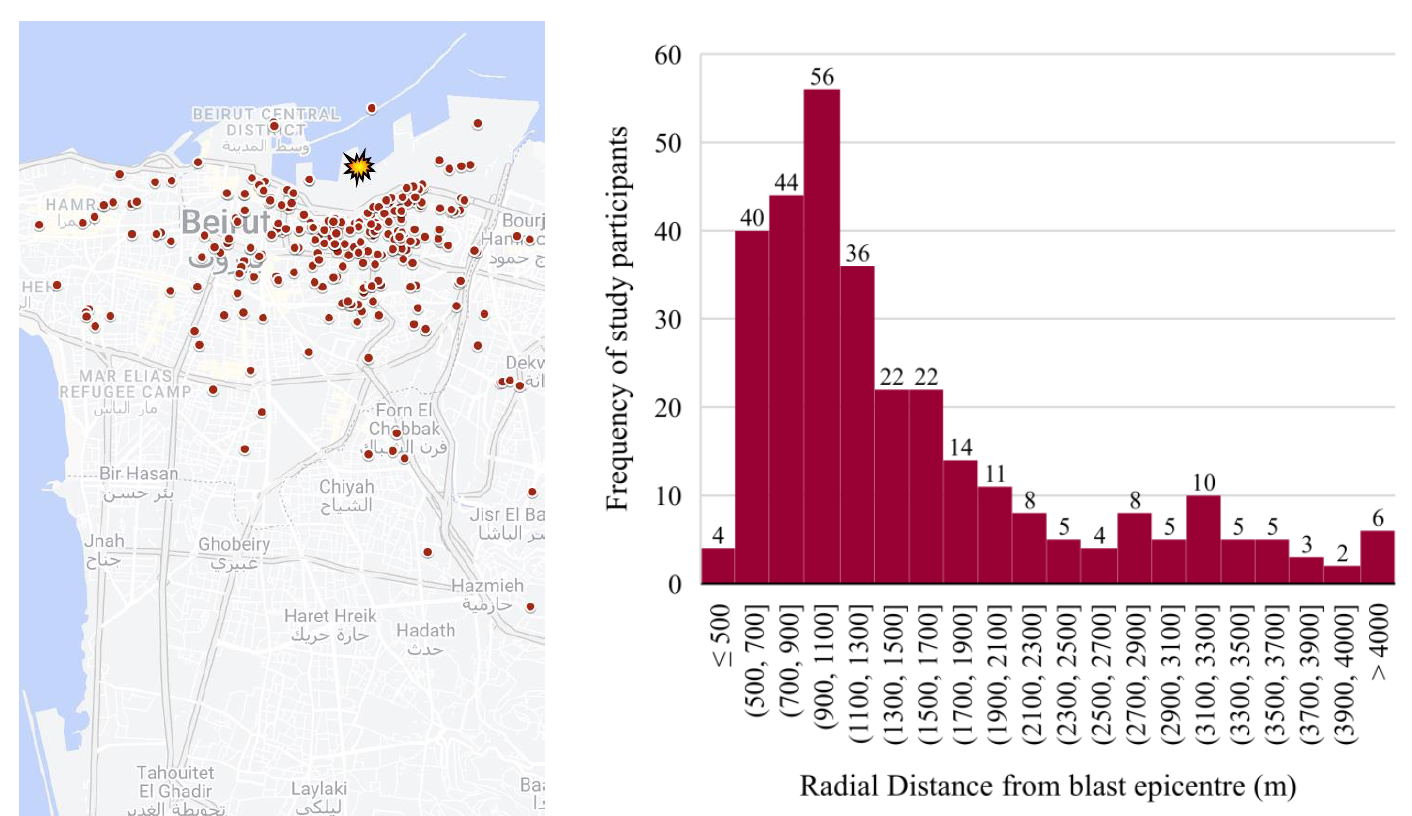
Previous investigations into the injury patterns resulting from the Beirut blast lack accurate documentation of victims’ locations at the time of the explosion. Such limitations stemmed from either improper documentation or the presumption that victims’ residential addresses corresponded to their locations during the explosion. As a large, city-scale explosion, a victim’s blast exposure will have been significantly influenced by their location, including distance from the port detonation, their elevation, and proximity to buildings.
Study Aims & Methods
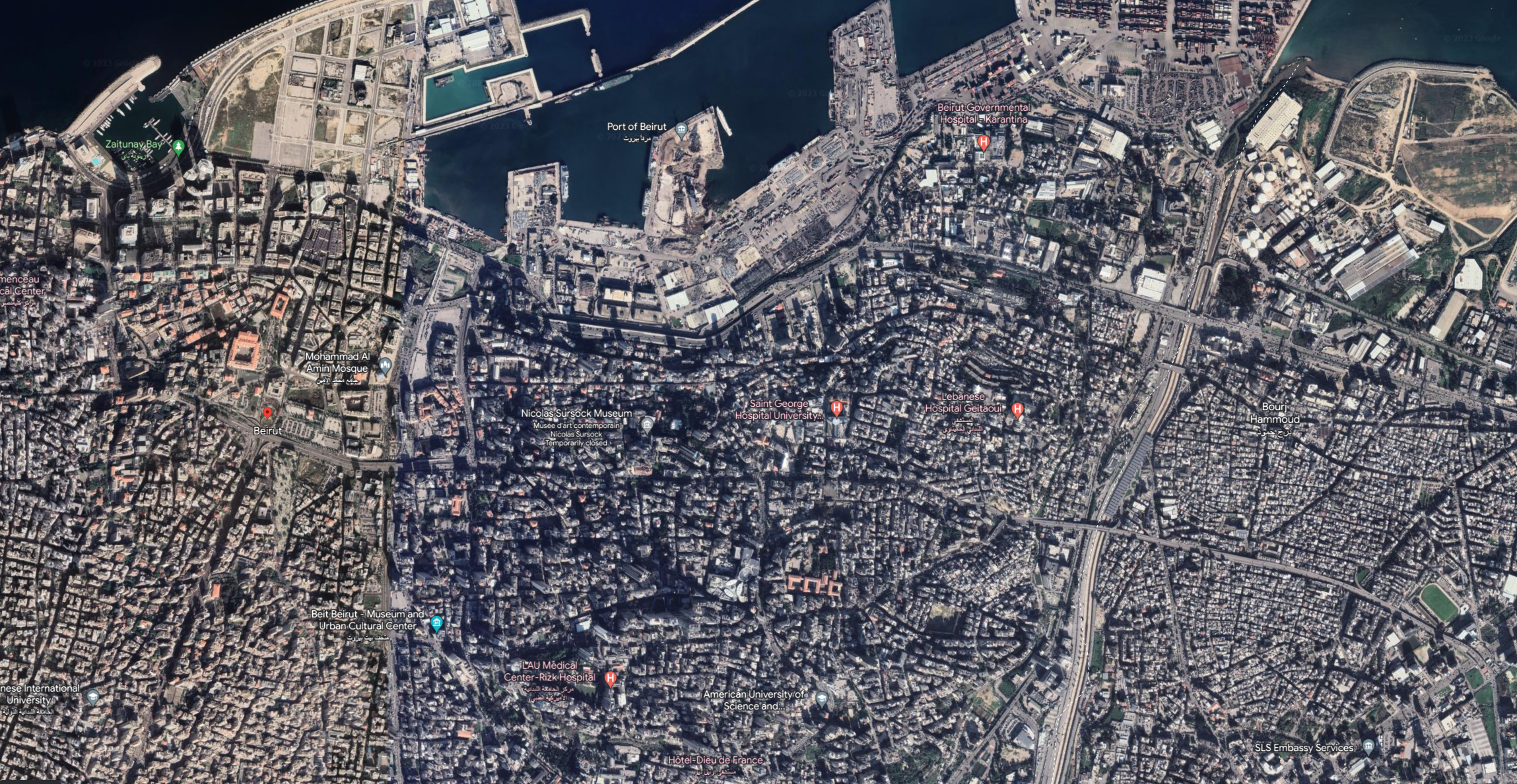
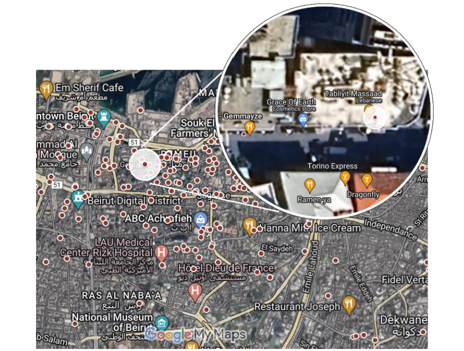
This study aimed to investigate blast injury victims’ exact locations and other contextual information at the time of the 2020 Beirut explosion. Patients were selected from existing Beirut blast injury databases and invited to participate in this study. Participants completed structured interviews which acquired information on their exact location at the time of the blast, their circumstances (i.e. posture, clothing coverage), detailed information of their immediate surroundings (i.e. whether they were inside or outside, proximity to glazing, elevation, type of building and orientation) and self-reported blast injuries alongside clinical records (with ISS scores) from prior injury databases. Locations were identified and accurately recorded with place markers using Google My Maps [3].
Conclusions
This study provides a comprehensive examination of spatial and contextual factors that contributed towards injury patterns and severities resulting from the 2020 Beirut Blast. This follow-up study identified the exact locations of the participants’, allowing for the first time, accurate calculation of their distance from the blast epicentre. The study findings hold immense significance as it provides new insights and improved understanding of how the surrounding urban environment and different contextual factors affect blast injury outcomes of a diverse and un-protected civilian population.
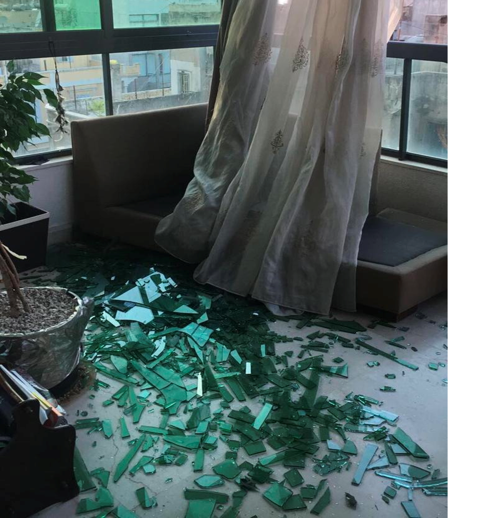
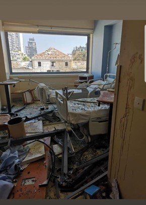
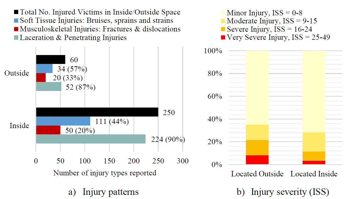
Our findings highlight the pronounced vulnerability of individuals in urban settings, particularly to lacerations and penetrating injuries. Risk factors such as room orientation, posture, proximity to glazing and distance from the blast epicentre had a significant influence on injury outcomes. Specifically, individuals situated inside rooms facing the port in close proximity to windows and glazing demonstrated heightened susceptibility to laceration and penetrating injuries. Conversely, those outdoors faced an increased risk of sustaining severe injuries, particularly musculoskeletal and soft tissue injuries. Synthesized knowledge and new understanding on the influence of the urban environment on blast injury risk is essential for informing practical mitigation strategies and sheltering guidance to reduced harm in both military and civilian settings.
Study Outputs
See Dr Denny et al. conference paper focussing on preliminary results and the estimation of blast loading conditions here.
The full study has been submitted for publication and is currently under review.
References
[1] Human Rights Watch, “They Killed Us from the Inside, An Investigation into the August 4 Beirut Blast,” (2021). Accessed: Sep. 21, 2023. [Online]. Available: https://www.hrw.org/report/2021/08/03/they-killed-us-inside/investigation-august-4-beirut-blast
[2] Action on Armed Violence (AOAV), “Explosive Violence Monitor 2022,” (2023). Accessed: Sep. 22, 2023. [Online]. Available: https://aoav.org.uk/2023/explosive-violence-monitor-2022/
[3] Google, “Google My Maps.” Accessed: Sep. 19, 2023. [Online]. Available: https://www.google.co.uk/maps/about/mymaps/
For more information or collaboration, contact Dr Jack Denny (jack.denny@soton.ac.uk).